 Passes, peaks, terraces and villages of Lai Chau, in English
Destinations · Trekking
Pu Ta Leng: 3,049 m of forest and rhododendron
Pu Ta Leng is the easiest of Lai Chau's 3,000 m peaks to reach and still a hard walk: two or three days of steep forest trail, a camp above 2,000 m and a summit that is often in cloud. Its season is short and its weather changes fast.
At a glance
- Height
- 3,049 m
- Commune
- Ta Leng (since 2025)
- From Lai Chau centre
- About 20 km
- Days
- 2–3 days, 1–2 nights on the mountain
- Season
- October–April
- Rhododendrons
- February–April, peak for 2–3 weeks
Sources: Lai Chau provincial tourism portal — Putaleng peak; Heritage magazine (Vietnam Airlines) — Putaleng; VnExpress — Lai Chau travel handbook (2024); Viet Nam News — conquering Pu Ta Leng (2017); Hoatieu — text of Resolution 1670/NQ-UBTVQH15 (new communes and their components) · last checked .
What the climb is like
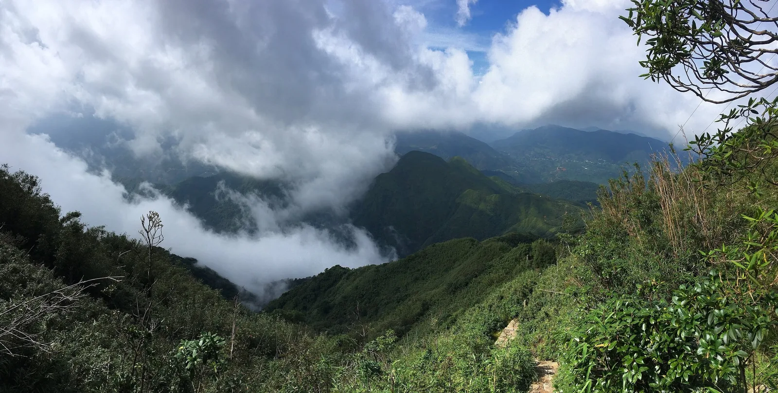
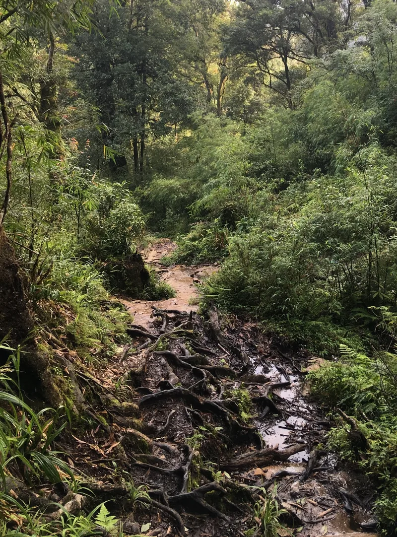
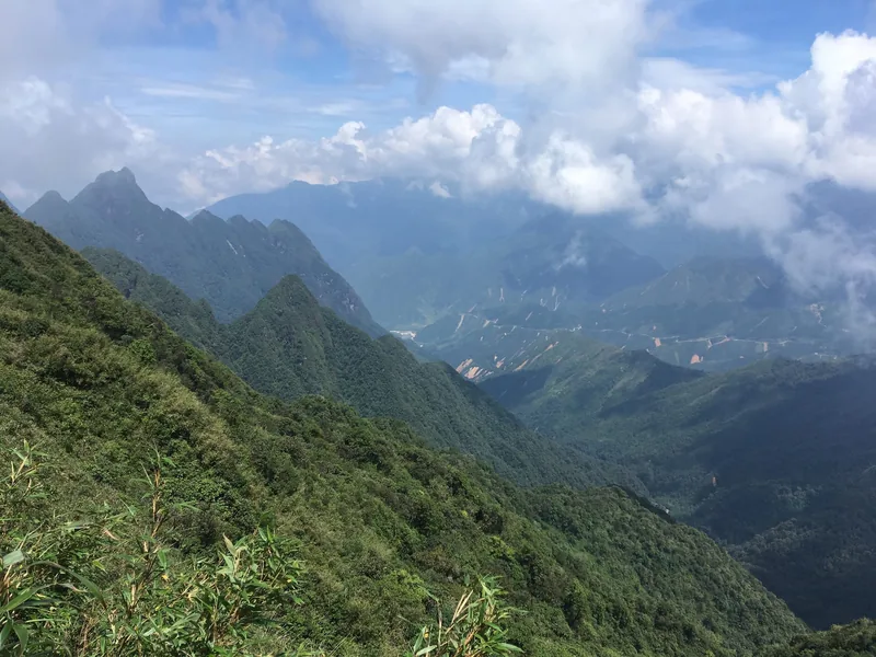
The provincial portal places Pu Ta Leng at 3,049 m, about 20 km north-east of the provincial centre, and describes primeval forest, waterfalls and azaleas on the way up. Press and magazine accounts are blunter. A 2017 report calls the slopes “steep, nearly vertical” in places, through tangled forest and broken rock, with a first day of eight to ten hours. The rhododendrons, purple and pink, grow on trees up to 7 m tall.
A 2024 trade-press article puts an old tea forest from about 2,500 m and the main rhododendron forest at about 2,900 m, with Fansipan visible from the summit on clear days. A 2024 magazine account describes a rest point at a cardamom hut at about 2,200 m. Clear days are the exception, not the rule: plan for the summit to be in cloud and be pleased if it is not.
Height lists vary. Pu Ta Leng is usually given as 3,049 m and as Vietnam's third-highest summit after Fansipan and Pu Si Lung; some sources call it the second. It does not matter on the trail, but it explains the mixed figures you will see.
Sources: Lai Chau provincial tourism portal — Putaleng peak; Viet Nam News — conquering Pu Ta Leng (2017); Tap chi Cong Thuong — the highest peaks of Tam Duong; Heritage magazine (Vietnam Airlines) — Putaleng · last checked .
Routes
All the usual routes start inside the new Ta Leng commune, formed in 2025 from the old communes of Giang Ma, Ho Thau and Ta Leng. A 2024 magazine account names four: Ho Thau, Ta Leng, Giang Ma and Si Thau Chai, and calls the Si Thau Chai route the hardest and most scenic.
| Route | Start | What sources say |
|---|---|---|
| Ho Thau | Turn off Highway 4D around Km 15 | Three days, two nights; first camp at about 2,400 m (2017 report) |
| Si Thau Chai | Dao hamlet at about 1,400–1,500 m | Steepest route; about three hours to the cardamom hut; done by one author in two days |
| Ta Leng | Village at about 1,800 m | Used as a descent route; second night near the village in the 2017 report |
| Giang Ma | Giang Ma area of Ta Leng commune | Named as a route; we found no detailed description |
Times and altitudes vary between accounts and depend on group fitness. Ask whoever organises the climb which route they use and where they camp.
Sources: Heritage magazine (Vietnam Airlines) — Putaleng; Viet Nam News — conquering Pu Ta Leng (2017); Vietnam Tourism Association portal — Si Thau Chai hamlet; Hoatieu — text of Resolution 1670/NQ-UBTVQH15 (new communes and their components) · last checked .
Rules, registration and guides
We found no official statement in 2026 that Pu Ta Leng needs a formal permit on the Lai Chau side, and the provincial portal lists it as free. Two things still apply. First, whoever hosts you, a homestay or a guide, must declare a foreign guest's stay to the police, within 24 hours in mountain areas. Second, in May 2026 Bat Xat National Park in neighbouring Lao Cai named Pu Ta Leng among the high peaks it asks visitors not to climb on their own, and said that operators, homestays and guides must declare guests to forest rangers before a climb. It cited fines of VND 4–6 million for sightseeing in a forest without the owner's permission.
In practice almost everyone climbs with a local guide or porter, and the routes are not waymarked in a way that makes solo walking sensible. The UK Foreign Office notes that some places in Vietnam make going without a guide illegal and advises using a reputable one in mountain areas. The permits page sets out the rules in more detail.
Rules for climbs in forest areas were tightened in 2026. Ask the commune office or your homestay what registration is needed for the route and date you plan, and carry your passport.
Sources: Lai Chau provincial tourism portal — Putaleng peak; Vietcetera — temporary residence rules for foreigners (2026); Lao Cai Newspaper — Bat Xat National Park warning on unplanned climbs; UK Foreign Office — Vietnam safety and security · last checked .
When to go
The provincial portal gives October to March as the most beautiful period; press accounts extend the climbing season to April. Rhododendrons flower from February to April, but a given slope is at its peak for only two or three weeks, so a date fixed months ahead is a gamble. From May to September the trail is wet and slippery, streams rise, leeches are common, and the views are usually lost in cloud.
Winter nights at the camp can drop close to freezing. Bring a sleeping bag rated for it even if one is supplied, and layers for a cold, wet summit morning.
Sources: Lai Chau provincial tourism portal — Putaleng peak; Heritage magazine (Vietnam Airlines) — Putaleng; VnExpress — Lai Chau travel handbook (2024) · last checked .
Getting to the trailheads
The trailheads are within an hour of the provincial centre, off Highway 4D towards the pass. Hanoi coaches stop at the provincial centre or at Tam Duong on the way. Most climbers arrange to be met at the bus and taken to a village homestay the evening before; the Si Thau Chai road was paved in 2015. See getting there for the coach from Hanoi.
Sources: redBus Vietnam — Hanoi to Lai Chau route page (booking platform); Vietnam Tourism Association portal — Si Thau Chai hamlet; Heritage magazine (Vietnam Airlines) — Putaleng · last checked .
Costs
We do not publish guide, porter or package rates; we found no official or press figure we would stand behind, and rates depend on group size, route and season. Ask what is included: food, tents, sleeping bags, porters for your bag, transport to the trailhead and the registration. A low price that leaves out porters or a second night is not cheaper on the mountain.
| Item | Range | Note |
|---|---|---|
| Entry to the peak | Free | Provincial portal listing |
| Homestay night near the trailhead | VND 300,000–800,000 | 2024 press range for Lai Chau village homestays |
| Coach Hanoi–Lai Chau | VND 250,000–400,000 | Bus type changes the fare |
Sources: Lai Chau provincial tourism portal — Putaleng peak; VnExpress — Lai Chau travel handbook (2024); redBus Vietnam — Hanoi to Lai Chau route page (booking platform) · last checked .
Pictures



Who should skip this, and when not to climb
- Walkers who have not done a long, steep day of eight hours or more with a pack.
- Anyone with knee problems: the descent is as hard as the climb.
- People who need a view to justify the effort; many summits are in cloud.
- Anyone who would go without a local guide, or without telling someone the route and return date.
- Climbs in the rainy months from May to September, and any day after heavy rain or with storms forecast.
Common questions
Questions readers ask
How many days does Pu Ta Leng take?
Usually three days and two nights; very fit walkers do it in two days with one night on the mountain.
When do the rhododendrons flower on Pu Ta Leng?
From February to April. Any given slope is at its peak for about two to three weeks.
Do I need a permit to climb Pu Ta Leng?
We found no formal permit requirement on the Lai Chau side, but your host must declare your stay, and in 2026 a neighbouring national park asked that climbers be declared to forest rangers. Check locally before you go.
Can I climb Pu Ta Leng without a guide?
It is not sensible. The trails are steep, unmarked in places and often in cloud, and official advice recommends a reputable local guide in mountain areas.
Related
Read next
Trekking
Trekking peaks
Pu Ta Leng, Bach Moc Luong Tu and Pu Si Lung compared: height, days, grade, season and permits.
Read more
Practical rules
Permits and registration
Border-area rules, temporary residence declarations and forest rules that apply to visitors in Lai Chau.
Read more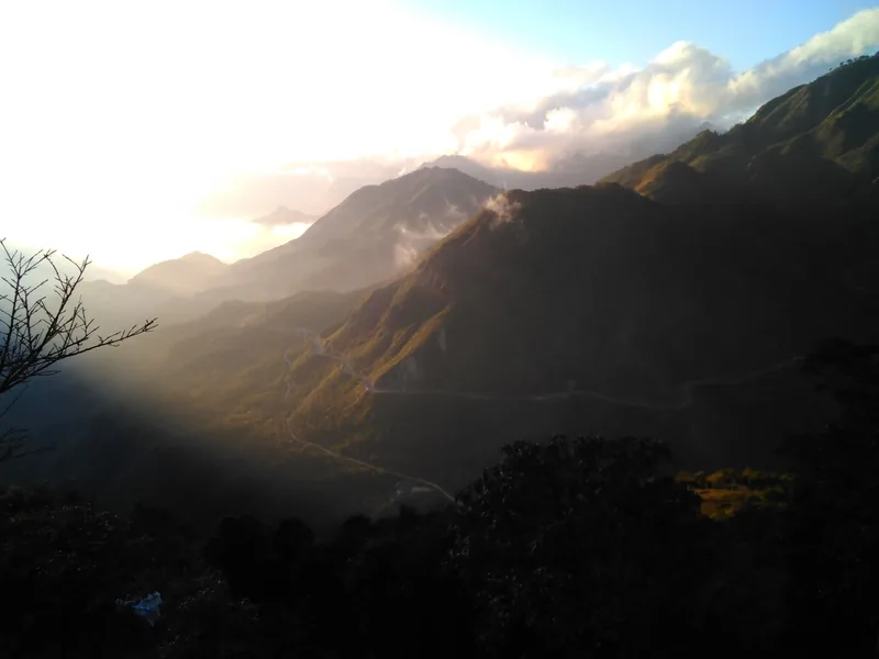
Seasons
When to go
Month-by-month guide to Lai Chau for road trips, treks, rhododendrons and the rice harvest.
Read more
Stays
Homestays
What a night in a Lai Chau village homestay is like: beds, meals, washing, money and manners.
Read more
Destinations
Destinations
The main areas of Lai Chau, how far apart they are, and which season suits each.
Read more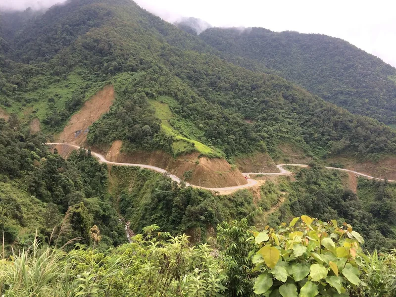
Safety
Road safety and weather
Landslides, fog, night buses and motorbike rules on Lai Chau's mountain roads, with dated examples.
Read more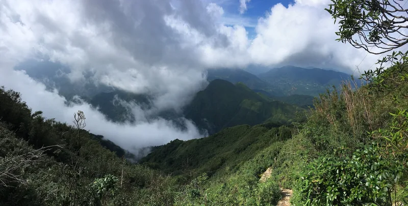
Start planning
Send a correction or a question
Tell us which page you mean, what you found on the road, the trail or an official site, and when. A link to the source helps us check it.